
SEIA
N 40.41960; W 7.70553
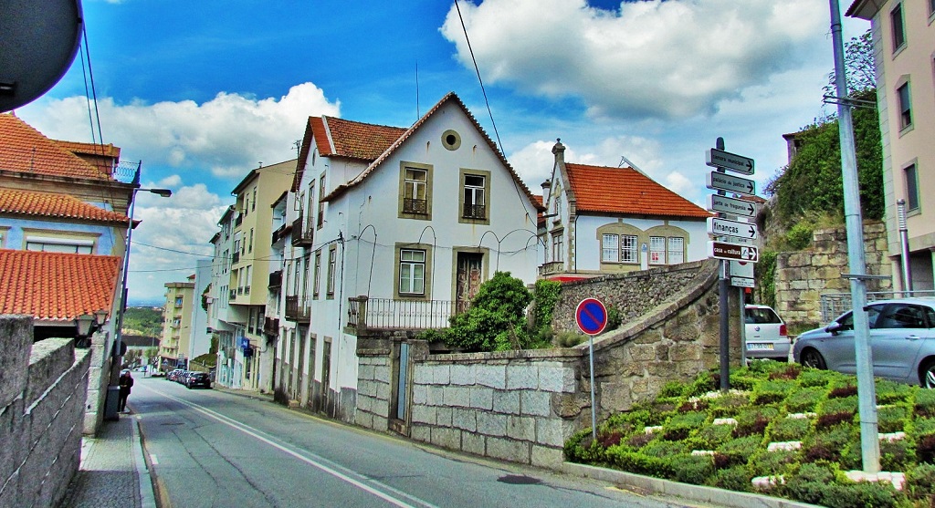
Seia is a Portuguese city in the district of Guarda, located in the province of Beira Alta, Centro region (Beiras Region) and sub-region of Serra da Estrela, with about 5 300 inhabitants.
It is the second largest city in the District of Guarda, belongs to the Intermunicipal Community of Beiras and Serra da Estrela and is roughly equidistant between the cities of Guarda and Viseu. Seia is, together with Covilhã and Manteigas, one of the municipalities that share the highest point in mainland Portugal (the Serra da Estrela Tower) and the second highest point in the whole country, just behind the Pico Mountain, in the Azores.
It is the seat of a municipality with 435.69 km² in area and 24 702 inhabitants (2011), subdivided into 21 parishes. The municipality is limited to the north by the municipalities of Nelas and Mangualde, to the northeast by Gouveia, to the east by Manteigas, to the southeast by Covilhã, to the southwest by Arganil and to the west by Oliveira do Hospital. In this municipality is located the highest point of mainland Portugal, the Torre, in Serra da Estrela, with 1 993 meters of altitude. The municipality of Seia covers a large part of Serra da Estrela and is also the only one in Portugal where there is a natural ski resort, the Vodafone Ski Resort, located within the limits of the parish of Loriga.
It is 98 km from Coimbra, 67 km from Guarda, 45 km from Viseu, 298 km from Lisbon and 163 km from Porto. It is served mainly by Nacional 17 and Nacional 231, which allow a connection to the A25, A24 and IP3.
Located on the western side of the Serra da Estrela, the city of Seia is 550 m above sea level. The climate is temperate, with moderate temperatures in summer and cold in winter, with very low temperatures and snow occurrences, sometimes abundant, in the highest parts of Serra da Estrela. As for the rainfall regime, there is a small dry season, which comprises the summer months of July and August.


💓💓💓💓💓
SEARCH IN ALPHABETICAL ORDER
IN THE DISTRICT OF GUARDA

Aguiar da Beira;
Almeida;
Almendra;
Castelo Bom;
Castelo Melhor;
Castelo Rodrigo;
Celorico da Beira;
Figueira de Castelo Rodrigo;
Fornos de Algodres;
Freixo de Numão;
Golfar + A-do-Cavalo;
Almeida;
Almendra;
Castelo Bom;
Castelo Melhor;
Castelo Rodrigo;
Celorico da Beira;
Figueira de Castelo Rodrigo;
Fornos de Algodres;
Freixo de Numão;
Golfar + A-do-Cavalo;
Moreira de Rei (Trancoso);
Numão;
Pinhel;
Ranhados;
Sabugal;
Seia;
Serra da Estrela Nature Park;
Sortelha;
Trancoso;
Valhelhas;
Vila Nova de Foz Côa;
Vilar Formoso;
Numão;
Pinhel;
Ranhados;
Sabugal;
Seia;
Serra da Estrela Nature Park;
Sortelha;
Trancoso;
Valhelhas;
Vila Nova de Foz Côa;
Vilar Formoso;
💓💓💓💓💓
Return to mainland Portugal &
the Azores and Madeira islands

